Eravikulam – The Landscape
As I mentioned in my previous post, the most striking thing about Eravikulam was the Landscape. The core area looks totally different from the tourism zone (Rajmalai), where 99.9% of the tourists land up.
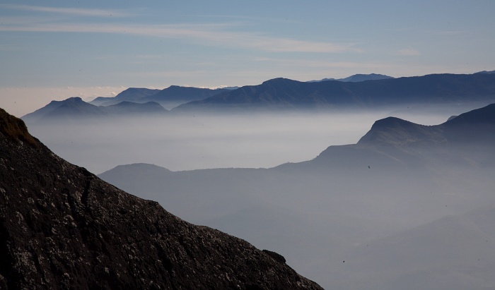
Most of the national park is about 2000 meters elevation, so most of the time, the peaks are above the clouds (hence called cloud forests). During winters, the temperature drops below freezing and even when I was there last week, the night temperatures were approaching close to freezing. I missed most of the morning golden light shots as it was just too cold to wake up early and walk few KM’s to get some shots. This was one of the only ones I managed.
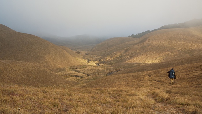
The whole park is surrounded by massive valleys and everything in between is just endless stretches of grasslands with small hills like these around. Though they are small peaks, it still is very exhausting to climb up and down these grass hills.
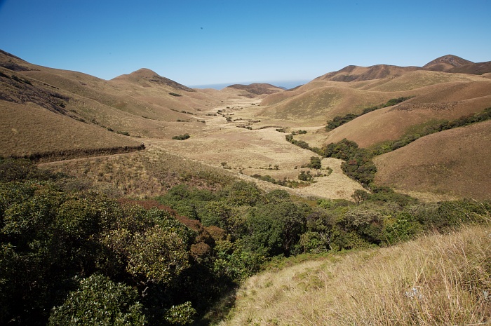
Most of the wildlife hides in these small patches of thick forests. These are called ‘Sholas’ and they are basically small islands of evergreen forests in middle of the grasslands. Most animals use this grassland just to jump from one shola to another. Once you enter these sholas, the temperatures drop, almost all of them have streams flowing inside them and is infested with birds. The mammals were hiding in the big sholas and we could only catch them in the camera traps as it was very tough to traverse through the sholas.
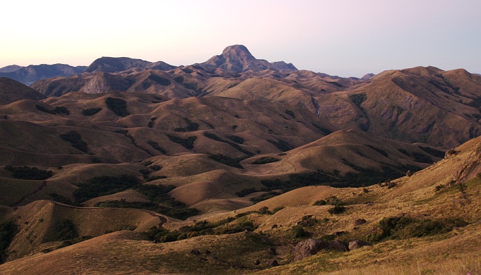
That is Anai mudi at the end. This photograph is from the furthest point of the national park to the base camp. You can pretty much get the idea of how most of the landscape looks like.
Hi Kalyan,
i met you in K gudi 2 years back. this has been a total surprise that other part of rajamalai is totally dry where as the tourist spot is green.
gorgeous!!!!!!!!!!!!
Well the whole of eravikulam is dry right now since summer is fast approching. Its green from May till Jan.
loved the last picture..
Oh man this looks like heaven — esp the last 2 images …
when you say mammals in sholas what are they ?? the vegetation looks so scarce apart from sholas — not sure how the big ones like elephants survive ( if they are there )
Lovely photographs…I think they are like paintings. If the mammals and birds are all in the sholas, they must be easy to spot…? And what about the grassland animals?
Awesome.. cant stop looking at them 🙂
Mammals are all the lesser mammals (leopard cat/jungle cat/civets/mongoose/otters) and large ones too like wild dogs/leopards/tigers and yes even elephants/gaur etc. Got them all on camera traps 🙂
Not at all.. dont know where they hide.. but even in small sholas where I knew there were lesser cats/otters etc.. it was just impossible to find them. .also its very tough to traverse through a shola unless there is some animal path.
Except for the niligir tahr, rest prefer the sholas 🙂
Awesome
Awesome Pics Kalyan. Any pics of LTM?
-Pramod.
Pics are just too good 🙂
Beautiful landscape. So unlike what I know of the western ghats
Geoencoding?!
Dude, why aren’t your shots geoencoded? Would love to look down on the sites from above….
-jfriedl
WOW
Fabulous
Any Wall paper sized ones available (1024×768)?
Any chance of seeing your camera trap photos?
Kartik
Will be there soon. 🙂
Woot! Looks like an excellent place to fly low between the mountains.
🙂
As Always Nice Pics!
That was the 1st thing that came into my mind when I looked at the vallerys 🙂
Re: Geoencoding?!
I did have a GPS unit, but not the came to connect it to the D200. Maybe I should just embed them using some exif tool. Let me try to geocode the next set of images.
Re: Awesome
No LTM’s in this park. However there are a lot of Nilgiri Langurs, but they were too shy even for my 400mm lens.
That is exactly what I am training for right now. I wish to be able to fly across India by myself (in a rented airplane for now). 🙂
You can check if there are any microlight or hang glider operations around that area. Towed glider rental and training rates in India are *very* cheap because the government has subsidized it. Last I read, it was something like Rs. 100 / hour which is ridiculously cheap.
Ah that is indeed simply lovely! 🙂
When you come down here.. lets do a ride. I’ve been looking for a service like this so that I can do some arial photography. What say ?
Deal!